Also known as Lake Canyon Rec Area, Miller Flat Campground is in Manti-LaSal National Forest. Take 400 North East of Fairview. This turns into UT-31 E/Canyon Rd. Follow UT-31 about 17 miles. Huntington Reservoir will be on your right. About 1/2 mile past Huntington Reservoir will be Miller Flat Road on your right. Turn here. There are lots of campsites in this area, 11, 17, 24 and 41 are reservation sites, the rest are first come first served. Long trailers can be parked at many of these sites. Here is the link: http://www.recreation.gov/camping/Miller_Flat_Group_Site_A_Ut/r/campgroundDetails.do?contractCode=NRSO&parkId=75005
The roads in this campground are wide gravel roads, fairly easy to navigate with large trailers.
Thursday, June 17, 2010

Gooseberry Campground, Near Fairview, UT
Gooseberry Campground is about ll miles east of Fairview. From Fairview on US-89, turn east on 400 north. This is UT-31 E. Go about 9 miles, turn left on UT-264 E at the Scofield sign and just to your left will be a large staging/parking area for North Skyline Dr. Drive north through that area and a sign says North Skyline Drive. Make a slight turn right after you enter Skyline Drive. Gooseberry Campground is about 2 miles down a winding dirt road. This is a small campground with vault toilets and potable water. It has 11 sites, 10 which are first come, first served and one (site # 4) is a reservable group site. The link is http://www.recreation.gov/camping/Gooseberry_Group_Ut/r/campgroundDetails.do?contractCode=NRSO&parkId=70825&topTabIndex=CampingSpot
The sites are pretty small. If you have a large trailer, sites 2, 3 and 4 are possibly large enough pull-throughs. Be sure to remove your trash as there are no trash receptacles there. If you don't want to camp in the small campground, there are areas just off North Skyline Drive where we saw some people camping just off the road.
The sites are pretty small. If you have a large trailer, sites 2, 3 and 4 are possibly large enough pull-throughs. Be sure to remove your trash as there are no trash receptacles there. If you don't want to camp in the small campground, there are areas just off North Skyline Drive where we saw some people camping just off the road.
Sunday, June 13, 2010
May 27 Ride 14 miles Northeast of Simpson Springs
 |
| Carpet Phlox (Phlox hoodii) |
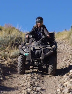
The dirt road leading north from the Pony Express Trail Rd. we chose was at approximately N 40 degrees 08.452' W 112 degrees 36.221, elevation 5485 ft. This was a road that full sized vehicles use. On our way north, we passed a family camping near a hill with ATV trails going up and down. We rode for a few miles then went right on a smaller ATV trail toward the east. This area was mostly flat, gradually leading to foothills. We saw a herd of antelope feeding on lush meadow grasses on this trail.
 |
| Foothills Death Camas (Zigadenus paniculatus) |
 |
| Vernal Daisy (Erigeron pumilus) |
 |
| Milk Vetch? |
 |
| Western Wallflower (Erysimum asperum) |
May 27 Visit to Simpson Springs
 |
| Simpson Springs Recreation Area Sign |
(All information in this posting of our blog is found on signs at Simpson Springs) In 1845, it took six months to get a message from the east coast of the United States to California. By the time it arrived, the news was old. In the late 1850s, a half million people had migrated west, and they wanted up-to-date news from home. Something had to be done to deliver mail faster and to improve communication in the expanding nation.
Competing with time, distance, harsh climate and hostile Indians, the Pony Express carried important communications from the East and the West across 2,000 miles between St. Joseph, Missouri and Sacramento, California in only 10 days. The "Pony," as it was called, is an outstanding example of American Courage, endurance and determination in the westard expansion of the Nation. Speeding mail and news across the country, the Pony was then a vital lifeline of the nation. It is credited with playing an important part in preserving our nation by keeping California in the Union at the outbreak of the Civil War.
Completion of the Transcontinental Telegraph Line in October, 1861, put an end to the Pony Express. The "talking wire" met the need for urgent communications and the Overland Stage served for general letters. Despite its high prices (up to $5.00 an ounce at its peak), the Pony Express was a losing enterprise from its beginning. Receipts were often high, but expenses were enormous. In spite of its contributions to the Union ant the westward expansion, the the Pony never received any financial assistance form the government.
Yet its founders, WH Russell, Alexander Majors, and William B Waddell felt the need was important, and the Pony Express operated in the red until it went out of business on October 28, 1861, four days after the first coast to coast telegraph message. The Pony Express captured the admiration, imagination, and hearts of people.
Pony Express relay stations were from 10 to 35 miles apart along the route and each had two to four men and extra horses. About 500 of the hardiest western mustang horses were bought at prices up to $200.00 each. A healthy horse could run at a full gallop for only 10 to 12 miles, so the Pony Express needed to build many new stations in remote areas across the Great Basin. There were about 80 riders in all, and they were recruited from the most daring, determined and toughest “wiry young fellows” in the West. Lightly equipped and armed with a Navy Colt revolver, each man rode at least 35 miles in each direction, changing horses at three relay stations along the way.
Over his saddle the rider carried the mochila, a leather cover with four mail pouches of letters. He wasted no time at the relay stations, stopping only for water and to transfer the precious mochila onto a waiting horse. Day and night, good weather and bad, winter and summer, the Pony Riders covered 10 to 15 miles an hour on their routes. Surprisingly, over the 18 months the Pony operated, (April 1860 to October 1861) only one mail pouch was lost and service was held up for only one month during the Indian Wars.
Mark Twain wrote in “Roughing It,” published in 1872, about his encounter with a Pony Express Rider in the summer of 1861: “Every neck is stretched and every eye strained...Across the endless prairie a black spec appears...In a second or two it becomes a horse and rider, rising and falling – sweeping toward us – growing more and more distinct, and the flutter of hoofs comes faintly to the ear – another instant a whoop and a hurrah from our upper deck, a wave of the rider's hand, but no reply, and man and horse burst past our excited faces, and go winging away like a belated fragment of a storm.”
Pony Express Monument at Simpson Springs
 |
| Pony Express Monument |
This monument shows the dates of the first and last couriers to visit Simpson Springs: "One of the important desert stations on the Pony Express and Overland Stage route...The first east-bound Pony Express Courier halted here about 5 P.M. April7, and west-bound about 2 A.M. April 10, 1860. The last riders passed about October 22, 1861..."
Friday, May 28, 2010
May 27 Visit to Simpson Springs
 |
| Panorama of area near Simpson Springs |
 |
| Simpson Springs Campground Sign |
 |
| Vault toilet at Simpson Springs, Utah |
We didn't stay and ride our ATVs at Simpson Springs, but the Utah BLM site http://www.blm.gov/ut/st/en/fo/salt_lake/recreation/camping/simspson_springs.html has information and a map of the area. According to the map, many of the trails are closed to motor vehicles.
Even though we didn't ride any trails at Simpson Springs, we took pictures of the site and will tell you a little about it.
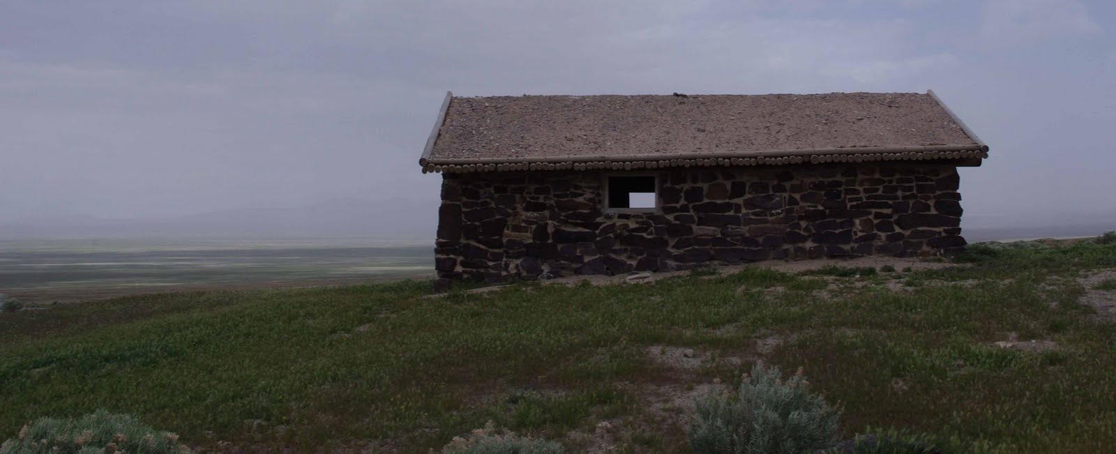 |
| Restored cabin at Simpson Springs |
A number of structures have been built and destroyed in the vicinity of Simpson Spring over the years, and it isn't known for sure which served as the station for the mail route and the Pony Express. This cabin is located at the approximate site of the original station and closely resembles the original. All information we tell here is written on signs around Simpson Springs.
One of the most dependable watering points in this desert region, Simpson Springs has long served man's needs. Indians used it, and early travelers and explorers counted on finding water here. It bears the name of one explorer, Captain J. H. Simpson, who stopped here in 1858 while searching for an overland mail route between Salt Lake City and California.George Chorpenning established a mail station at this site in 1858, which was later used by the Pony Express and Overland Express (the mail companies built small dams across the water course to improve the reliable, but limited, supply of water). When gold mining started west of here at Gold Hill in 1893, Simpson Springs took on new importance as a station for freighters and stages until the mid 1920's. In the 1930's, the spring became the water supply for a Civilian Conservation Corps Camp located south of here.
George Chorpenning did not benefit from the effort and money he spent building the mail stations. In 1859 financial troubles struck. Chorpenning's government mail contracts were suddenly reduced; no money reached route employees during the fall. Chorpenning's animals were "attached" and sold for back wages. William Russell acquired the new mail contract. Chorpenning notes that Russell "stepped in, hired my men, took possession of my stations, provisions, improvements..." Thanks to Chorpenning, the Pony Express was in business.
 |
| Inside the cabin |
Friday, May 21, 2010
Rocky Ridge at Five Mile Pass
 |
| Rocky Ridge at Five Mile Pass |
When we drove around Fivemile Pass on Monday, May 10, it was chilly and raining lightly at times. We didn't see anyone on the trails, except we passed a family camping along the roadside. On the way out, we stayed to the west on flat roads but came back going up and down in the foothills.
Subscribe to:
Posts (Atom)