 |
| Shoshone Trail 43 |
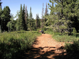
We left Road 059 (AKA Shoshone Trail 5) and took a trail that veered slightly to the right (east) toward Lambs Canyon. The sign said Shoshone Trail 43 started there. The sign said it was a "more difficult" trail. This means the trail can have "loose gravel, sandy, rocky or slickrock surface. May have short sections which are narrow. Can have blind turns, steep or roller coaster grades, minor drop-offs, dust, ruts and frequent changes in riding surfaces. Occasional obstacles may strike the frame." This trail had a little of most of those things, but not to any extreme degrees. The scenery varied between dry sagebrush areas to conifer forests.
We staged at N 41 degrees 30.747 W 111 degrees 27.973 elev. 8608 ft. The trail climbed gradually as we went north. We took a few side roads which dead ended within a mile or two from the main trail. It was about 25 miles round trip. We came back down Road 059 on the way back because we were running out of daylight. If you stay on Road 059 with your ATVs, it is considered an easy trail.
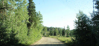 |
| Road 059 on the way down to State Route 39 |


No comments:
Post a Comment