 |
| MVUM Monk's Hollow ATV Trail |
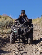
The dotted lines indicate motorcycle only trails. The broken lines (- - -) represent trails open to vehicles 50 inches or less in width. After going over the small ATV gate, there is a gravel road. We followed the road a short distance but came to the motorcycle trail. We turned around, and by the ATV gate, we turned up Trail 126. We began on trail 126 for ATVs. Trails 125 and 318 are labeled as moderately difficult. We started to go on Trail 318 heading to Teat Mountain, but it began with steep rocky rutted switchbacks and we turned around and continued on Trail 125.
No comments:
Post a Comment