Friday, May 28, 2010

May 27 Visit to Simpson Springs

Simpson springs Utah
Panorama of area near Simpson Springs


Simpsons springs campground sign
Simpson Springs Campground Sign


vault toilet at Simpson Springs
Vault toilet at Simpson Springs, Utah
Simpson Springs Recreation Area and Campground is about 94 miles southwest of Salt Lake City, Utah. It can be reached by going through Cedar Fort then west through Rush Valley on Cedar Fort Rd then turning on Pony Express Rd. or going south through Tooele Valley along UT-36, turning right at Pony Express Rd. Pony Express Road turns into Simpson Springs Road. The road is paved, but turns eventually into a graded gravel road that should be passable by automobile. The GPS coordinates near the Pony Express Monument and campground are N 40 degrees 02.378' W 112 degrees 47.213' Elev. 4916. The campground has 19 campsites. The fee was $5.00 per night. We had a long trailer and it was hard to navigate the corners in the campground. Most of the campground sites are small so we decided not to park there. A sign at the campground said that parking for longer than a half hour without paying for a campsite was prohibited. There were no staging areas (besides the campground spots) to pull our vehicle over and get the ATVs off, so we went back northeast about 14 miles back along Pony Express Road and found a dirt road that led north. There are several dirt roads and trails leading off Pony Express Rd./Simpson Springs Rd. Remember that while on BLM land, stay on the trails and obey signs. If the sign says a trail is closed to motorized traffic, please don't go on it.
      We didn't stay and ride our ATVs at Simpson Springs, but the Utah BLM site http://www.blm.gov/ut/st/en/fo/salt_lake/recreation/camping/simspson_springs.html has information and a map of the area. According to the map, many of the trails are closed to motor vehicles.
     Even though we didn't ride any trails at Simpson Springs, we took pictures of the site and will tell you a little about it.
cabin at Simpson springs
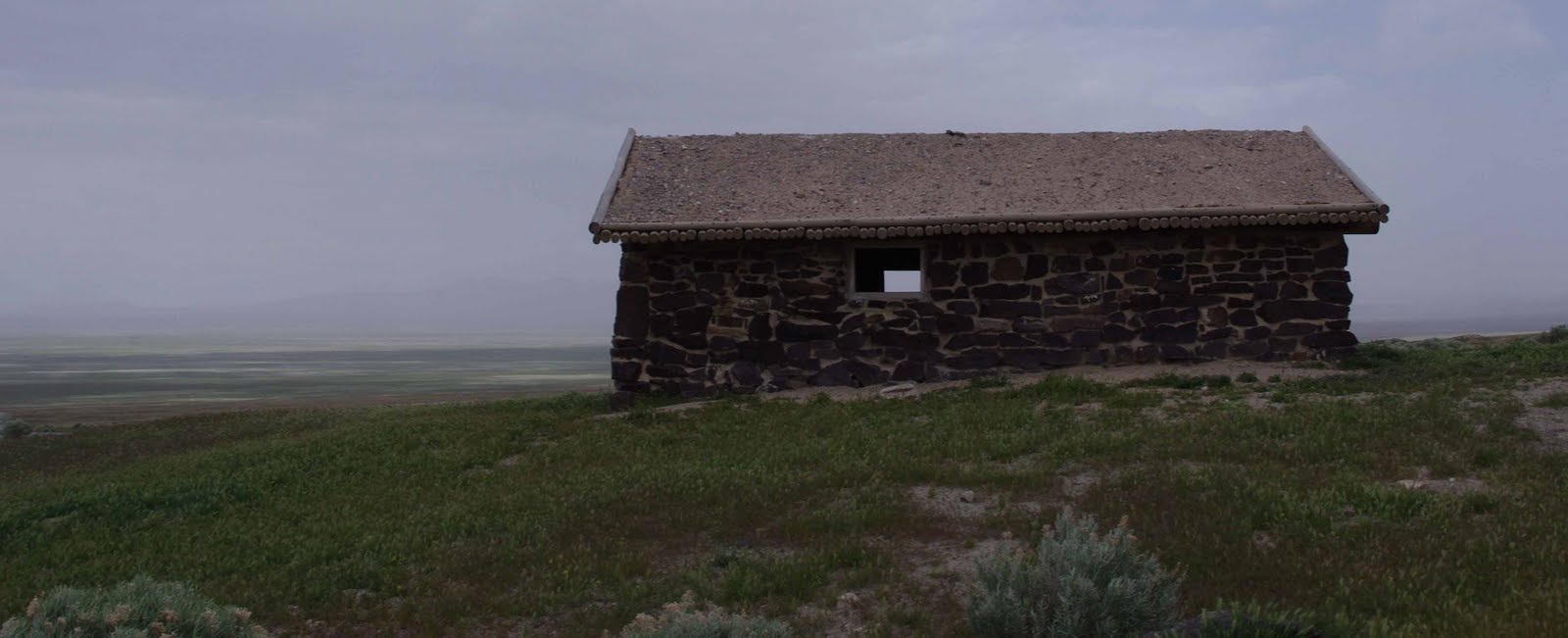
Restored cabin at Simpson Springs
     A number of structures have been built and destroyed in the vicinity of Simpson Spring over the years, and it isn't known for sure which served as the station for the mail route and the Pony Express. This cabin is located at the approximate site of the original station and closely resembles the original. All information we tell here is written on signs around Simpson Springs.
     One of the most dependable watering points in this desert region, Simpson Springs has long served man's needs. Indians used it, and early travelers and explorers counted on finding water here. It bears the name of one explorer, Captain J. H. Simpson, who stopped here in 1858 while searching for an overland mail route between Salt Lake City and California.
     George Chorpenning established a mail station at this site in 1858, which was later used by the Pony Express and Overland Express (the mail companies built small dams across the water course to improve the reliable, but limited, supply of water). When gold mining started west of here at Gold Hill in 1893, Simpson Springs took on new importance as a station for freighters and stages until the mid 1920's. In the 1930's, the spring became the water supply for a Civilian Conservation Corps Camp located south of here.
     George Chorpenning did not benefit from the effort and money he spent building the mail stations. In 1859 financial troubles struck. Chorpenning's government mail contracts were suddenly reduced; no money reached route employees during the fall. Chorpenning's animals were "attached" and sold for back wages. William Russell acquired the new mail contract. Chorpenning notes that Russell "stepped in, hired my men, took possession of my stations, provisions, improvements..." Thanks to Chorpenning, the Pony Express was in business.
interior of the pony express station at Simpson Springs
Inside the cabin
     

Friday, May 21, 2010

Rocky Ridge at Five Mile Pass

rocky ridge at Five Mile Pass Utah
Rocky Ridge at Five Mile Pass

When we drove around Fivemile Pass on Monday, May 10, it was chilly and raining lightly at times. We didn't see anyone on the trails, except we passed a family camping along the roadside. On the way out, we stayed to the west on flat roads but came back going up and down in the foothills.

Saturday, May 15, 2010

May 10 visit to Five Mile Pass


horned toad short-horned lizard
Horned Toad (Short-horned lizard)
On our second visit to Five Mile Pass, we parked on the west side of the parking area and headed west then south on a graded rocky road. A horned toad ran across the road in front of me and hid under a tiny sagebrush. We slowly moved the sagebrush aside and took this picture of our little friend. I read that horned toads can ward off predators by puffing up their bodies which makes their spikes become more pronounced and some species can squirt blood from their eyes up to 3 feet to surprise their predators. I also read that horned toads are becoming more rare because of loss of habitat. I believe this is the first time I've ever seen one.


wild buckwheat eriogonum ovalifolium
Wild Buckwheat


Wild Buckwheat? (Eriogonum ovalifolium)
We traveled to the higher elevations of the foothills and ate lunch near these wildflowers. I think I labeled them correctly. If not, will you leave a comment and correct me?


red Indian Paintbrush Castilleja
Indian Paintbrush


Indian Paintbrush (Castilleja)
These little bright red flowers were attention-getting. They were down in the lower altitude trails.


white wildflower mountain phlox phlox diffusa
Mountain Phlox


Mountain Phlox? (Phlox diffusa)
These were tiny 1/2 inch flowers hugging the ground, also in the higher foothill areas.

Tuesday, May 4, 2010

Five Mile Pass Trail

typical trail at Five Mile Pass Utah
Riding in the Foothills at Five Mile Pass
A Typical View of the Trail
Riding through the foothills surrounded by cedar trees and sagebrush. Occasionally coming upon ravines which can be steep.