Thursday, August 26, 2010

Shoshone Trail 43 Ogden Ranger District

Shoshone Trail 43 Uinta-Wasatch-Cache National Forest Ogden Ranger District
Shoshone Trail 43
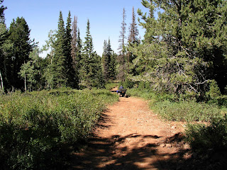
We left Road 059 (AKA Shoshone Trail 5) and took a trail that veered slightly to the right (east) toward Lambs Canyon. The sign said Shoshone Trail 43 started there. The sign said it was a "more difficult" trail. This means the trail can have "loose gravel, sandy, rocky or slickrock surface. May have short sections which are narrow. Can have blind turns, steep or roller coaster grades, minor drop-offs, dust, ruts and frequent changes in riding surfaces. Occasional obstacles may strike the frame." This trail had a little of most of those things, but not to any extreme degrees. The scenery varied between dry sagebrush areas to conifer forests.


We staged at N 41 degrees 30.747 W 111 degrees 27.973 elev. 8608 ft. The trail climbed gradually as we went north. We took a few side roads which dead ended within a mile or two from the main trail. It was about 25 miles round trip. We came back down Road 059 on the way back because we were running out of daylight. If you stay on Road 059 with your ATVs, it is considered an easy trail.
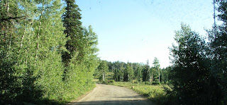
Road 59 in Uinta Wasatch Cache National Forest Ogden Ranger District Monte Cristo area
Road 059 on the way down to State Route 39

Views from Monte Cristo Area, Ogden Ranger District

View from Curtis Ridge on Road 059, Uinta Wasatch Cache National Forest Ogden Ranger District
View to the east from Curtis Ridge on Road 059, Ogden Ranger District

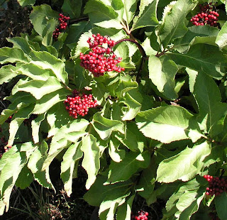
Red Elderberry Sambucus racemosa or Sambucus nigra
Red Elderberry (Sambucus racemosa)


The berries look good but are inedible.

Arbs Basin in Uinta Wasatch Cache National Forest

Arbs Basin Sign on Road 059, Ogden Ranger District

Arbs Basin View, Uinta Wasatch Cache National Forest

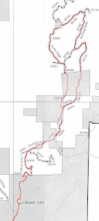
Motor Vehicle Use Map of Ogden Ranger District

Motor Vehicle Use Map of Monte Cristo area of Ogden Ranger District
ATV Route we took in
Monte Cristo Area
Highlighted in Red


Road 059 (also known as Shoshone Trail 5) is a gravel road, very narrow most of the way. It's hard to pass other full-size vehicles. One vehicle must come to a stop as far off the side as possible while the other passes slowly. The gray boxes represent private property scattered throughout the forest.

Wednesday, August 25, 2010

Monte Cristo Staging Area

The staging area for this trail is pretty small if you park at the entrance to Road 059 next to Highway 39. There isn't very much room, especially if you have a large trailer. Dispersed camping is allowed on Road 059 as long as it is within the boundaries of Uinta-Wasatch-Cache National Forest. You must be careful, though, because this area is a patchwork of private property interspersed within the national forest. Heed the signs along the road. If it says it's private property, don't park or ride your ATVs there! Wait until you see signs saying you are entering back into the national forest. We parked next to Road 059 and unloaded our ATVs just south of Arbs Basin. Arbs basin is about 5 miles north on Road 059.
Staging Area (Road 059)


Staging area Just off State Route 39 to Monte Cristo Area, Ogden Ranger District
Staging Area Just off SR 39

Just past this staging area are signs that say you are entering private property. Make sure you stay on the main road through these properties. Private property owners are allowing us to go through their land to access the national forest. Please don't abuse that privilege.

August 23 Visit to Monte Cristo Area East of Ogden Utah

Monte Cristo is 31 miles east of Huntsville, Utah. It's part of the Uinta-Wasatch-Cache National Forest Ogden Ranger District. To get there from Huntsville, take State Route 39 east for 31 miles. Watch for Curtis Creek Road (059) which is 1.1 miles past Monte Cristo Campground. Click the next link for more information on the Uinta-Wasatch-Cache National Forest, Ogden Ranger District OHV trails: National Forest Ogden Ranger District

We thought that we would have a better chance of getting a Motor Vehicle Use Map at the Ogden Ranger District on 507 25th Street, but a security guard in that building said that we would have better luck at the Union Station Information Center at 2501 Wall Ave. Ogden. He told me to go ahead and sign in and directed me to the Ogden Ranger District room down the hall to see if they had the map since we were already there. They did have the map there, but you may want to try the Union Station Information Center first.

The Motor Vehicle Use Map is a black and white booklet with about 30 pages that breaks down the Ogden Ranger District into 27 maps slightly overlapping each other. You can download the PDF File "Ogden Ranger District map" on the Uinta-Wasatch-Cache National Forest website here

Monday, August 2, 2010

Trail 245 Pretty Pond, Tansy Mustard, Yellow Paintbrush

Pretty Pond along Trail 245

Tansy Mustard Descurainia sophia
Tansy Mustard (Descurainia sophia)

Yellow Paintbrush Castilleja sulphurea
Yellow Paintbrush (Castilleja sulphurea)

Sunday, August 1, 2010

Trail 245 Slender Cinquefoil, Western Coneflower, Whipple's Penstemon

Slender Cinquefoil Potentilla gracilis
Slender Cinquefoil (Potentilla gracilis)

Western Coneflower Rudbeckia occidentalis
Western Coneflower (Rudbeckia occidentalis)

Whipple's Penstemon Penstemon whippleanus
Whipple's Penstemon (Penstemon whippleanus)

Trail 245 Nodding Thistle, Richardson's Geranium, Sego Lily, Showy Goldeneye

Nodding Thistle Carduus nutans
Nodding Thistle (Carduus nutans)

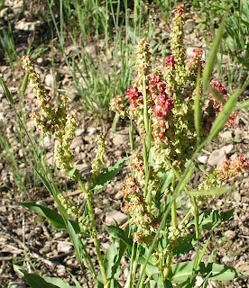
unknown red flower
Unknown Red Flower

Richardson's Geranium Geranium richardsonii
Richardson's Geranium (Geranium richardsonii)

Utah's State Flower Sego Lily Calorchortus nuttallii
Sego Lily (Calochortus nuttallii) Utah's State Flower


We came across a patch of Sego Lilies in a sunny meadow.
They were almost hidden among other plants.

Showy Goldeneye Viguiera multiflora
Showy Goldeneye (Viguiera multiflora)

Red Ledge

Red Ledge north of Strawberry Reservoir
 Panorama of Red Ledge
On the east side of Trail 245 is a big wall of red cliffs named Red Ledge. A sheepherder's horses are in the foreground. A side trail (seen toward the right) dead ends near the base of the cliffs in the trees.