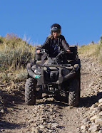
Monte Cristo is 31 miles east of Huntsville, Utah. It's part of the Uinta-Wasatch-Cache National Forest Ogden Ranger District. To get there from Huntsville, take State Route 39 east for 31 miles. Watch for Curtis Creek Road (059) which is 1.1 miles past Monte Cristo Campground. Click the next link for more information on the Uinta-Wasatch-Cache National Forest, Ogden Ranger District OHV trails: National Forest Ogden Ranger District
We thought that we would have a better chance of getting a Motor Vehicle Use Map at the Ogden Ranger District on 507 25th Street, but a security guard in that building said that we would have better luck at the Union Station Information Center at 2501 Wall Ave. Ogden. He told me to go ahead and sign in and directed me to the Ogden Ranger District room down the hall to see if they had the map since we were already there. They did have the map there, but you may want to try the Union Station Information Center first.
The Motor Vehicle Use Map is a black and white booklet with about 30 pages that breaks down the Ogden Ranger District into 27 maps slightly overlapping each other. You can download the PDF File "Ogden Ranger District map" on the Uinta-Wasatch-Cache National Forest website here
Wednesday, August 25, 2010
August 23 Visit to Monte Cristo Area East of Ogden Utah
Subscribe to:
Post Comments (Atom)

No comments:
Post a Comment