 |
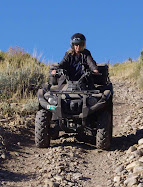
| Motor Vehicle Use Map for Worm Fence Trail and Little Bear Trail |
Sunday, September 26, 2010
Motor Vehicle Use Map Logan Ranger District Uinta-Wasatch-Cache National Forest
A copy of the Motor Vehicle Use Map of the Logan Ranger District can be picked up at Logan Ranger District, 1500 E Highway 89, Logan, Utah. A map can be downloaded at Uinta-Wasatch-Cache National Forest- Maps & Publications and click on Logan Ranger District. The Trail is approximately 8.2 miles long and ends at Shoshone Trail 3 (Road 055) on the north and begins on the south end at Shoshone Trail 30 (Temple Fork Road.)
Subscribe to:
Post Comments (Atom)

No comments:
Post a Comment