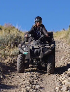
This trail is just south of Smith and Morehouse Reservoir about 16 miles east of Oakley Utah. From Oakley, go east on Weber Canyon road just past Smith and Morehouse Reservoir. A fairly large staging area is on the left just past the reservoir and before you get to Ledgefork Campground. The GPS coordinates were N40 degrees 44.643 W 111 degrees 05.972. The elevation was 7623 ft. The trail starts across the street and winds up the hill. A motor vehicle use map can be picked up at the Kamas Ranger District on 50 East Center Street, Kamas, Ut. A pdf copy can be obtained by clicking here.
Kamas Ranger District Map
 |
| Staging area at Smith & Morehouse ATV Trailhead |
 |
| Smith and Morehouse ATV Trail |