Showing posts with label Wasatch-Cache National Forest Kamas Ranger District. Show all posts

Thursday, September 9, 2010

Smith and Morehouse ATV Trailhead

Trailhead to Smith and Morehouse ATV Trail
Trail head to Smith and Morehouse ATV trail
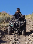
This was labeled Trail 030 on the post just past the yellow sign. The trail ascends through pines and aspen and parallels Red Pine Creek, then climbs to Mud Lake Flat and Shingle Mill Flat. We turned around after we went approximately 7 miles and we hadn't come to the end of the trail. It is quite rocky in many places. It is rated "moderate." Some places are difficult.

Another trail, no. 909 leaves trail 030 about 2 3/4 miles from the trail-head.  It goes to the southwest and is about 3/4 mile long, also coming to a dead end.

Wednesday, September 8, 2010

September 7 Visit to Smith and Morehouse Trail

This trail is just south of Smith and Morehouse Reservoir about 16 miles east of Oakley Utah. From Oakley, go east on Weber Canyon road just past Smith and Morehouse Reservoir. A fairly large staging area is on the left just past the reservoir and before you get to Ledgefork Campground. The GPS coordinates were N40 degrees 44.643 W 111 degrees 05.972. The elevation was 7623 ft. The trail starts across the street and winds up the hill. A motor vehicle use map can be picked up at the Kamas Ranger District on 50 East Center Street, Kamas, Ut. A pdf copy can be obtained by clicking here. Kamas Ranger District Map

Staging area at Smith and Morehouse Trailhead
Staging area at Smith & Morehouse ATV Trailhead

Smith and Morehouse trail map
Smith and Morehouse ATV Trail