Friday, September 10, 2010

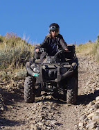
Smith & Morehouse ATV Trail

Sign road closed May 1 to June 15
Road Closed sign along Trail 030
Trail 80030 is closed between May 1 to June 15 for watershed protection due to wet road conditions.


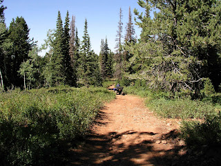
Trail near Ledgefork Campground south of Smith and Morehouse Reservoir
Smith & MorehouseTrail 030 Near Ledgefork Campground

Thursday, September 9, 2010

Smith and Morehouse ATV Trailhead

Trailhead to Smith and Morehouse ATV Trail
Trail head to Smith and Morehouse ATV trail
This was labeled Trail 030 on the post just past the yellow sign. The trail ascends through pines and aspen and parallels Red Pine Creek, then climbs to Mud Lake Flat and Shingle Mill Flat. We turned around after we went approximately 7 miles and we hadn't come to the end of the trail. It is quite rocky in many places. It is rated "moderate." Some places are difficult.

Another trail, no. 909 leaves trail 030 about 2 3/4 miles from the trail-head.  It goes to the southwest and is about 3/4 mile long, also coming to a dead end.

Map of Terrain at Smith and Morehouse

Here is a Google Map of the area south of Smith and Morehouse Reservoir showing the terrain and altitude.

View Larger Map

Wednesday, September 8, 2010

September 7 Visit to Smith and Morehouse Trail

This trail is just south of Smith and Morehouse Reservoir about 16 miles east of Oakley Utah. From Oakley, go east on Weber Canyon road just past Smith and Morehouse Reservoir. A fairly large staging area is on the left just past the reservoir and before you get to Ledgefork Campground. The GPS coordinates were N40 degrees 44.643 W 111 degrees 05.972. The elevation was 7623 ft. The trail starts across the street and winds up the hill. A motor vehicle use map can be picked up at the Kamas Ranger District on 50 East Center Street, Kamas, Ut. A pdf copy can be obtained by clicking here. Kamas Ranger District Map

Staging area at Smith and Morehouse Trailhead
Staging area at Smith & Morehouse ATV Trailhead

Smith and Morehouse trail map
Smith and Morehouse ATV Trail

Thursday, August 26, 2010

Shoshone Trail 43 Ogden Ranger District

Shoshone Trail 43 Uinta-Wasatch-Cache National Forest Ogden Ranger District
Shoshone Trail 43
We left Road 059 (AKA Shoshone Trail 5) and took a trail that veered slightly to the right (east) toward Lambs Canyon. The sign said Shoshone Trail 43 started there. The sign said it was a "more difficult" trail. This means the trail can have "loose gravel, sandy, rocky or slickrock surface. May have short sections which are narrow. Can have blind turns, steep or roller coaster grades, minor drop-offs, dust, ruts and frequent changes in riding surfaces. Occasional obstacles may strike the frame." This trail had a little of most of those things, but not to any extreme degrees. The scenery varied between dry sagebrush areas to conifer forests.


We staged at N 41 degrees 30.747 W 111 degrees 27.973 elev. 8608 ft. The trail climbed gradually as we went north. We took a few side roads which dead ended within a mile or two from the main trail. It was about 25 miles round trip. We came back down Road 059 on the way back because we were running out of daylight. If you stay on Road 059 with your ATVs, it is considered an easy trail.
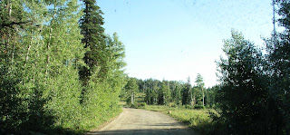
Road 59 in Uinta Wasatch Cache National Forest Ogden Ranger District Monte Cristo area
Road 059 on the way down to State Route 39

Views from Monte Cristo Area, Ogden Ranger District

View from Curtis Ridge on Road 059, Uinta Wasatch Cache National Forest Ogden Ranger District
View to the east from Curtis Ridge on Road 059, Ogden Ranger District

Red Elderberry Sambucus racemosa or Sambucus nigra
Red Elderberry (Sambucus racemosa)


The berries look good but are inedible.

Arbs Basin in Uinta Wasatch Cache National Forest

Arbs Basin Sign on Road 059, Ogden Ranger District

Arbs Basin View, Uinta Wasatch Cache National Forest